Long Distance Mountain Bike Trail, Stage 9 – From Lauris to Mérindol

Route
Crossing
Difficulty
Difficult
Duration
5h
Distance
55.54km
Positive elevation
1558 meters
Negative elevation
1 meters
Altitude
Min. 98 meters
Max. 707 meters
- circuit
- variante
- voie verte
- liaison
The tourist service at Lauris :
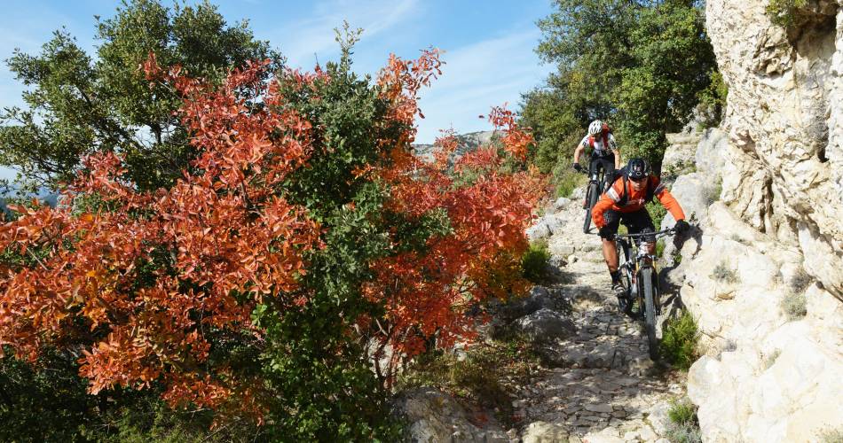
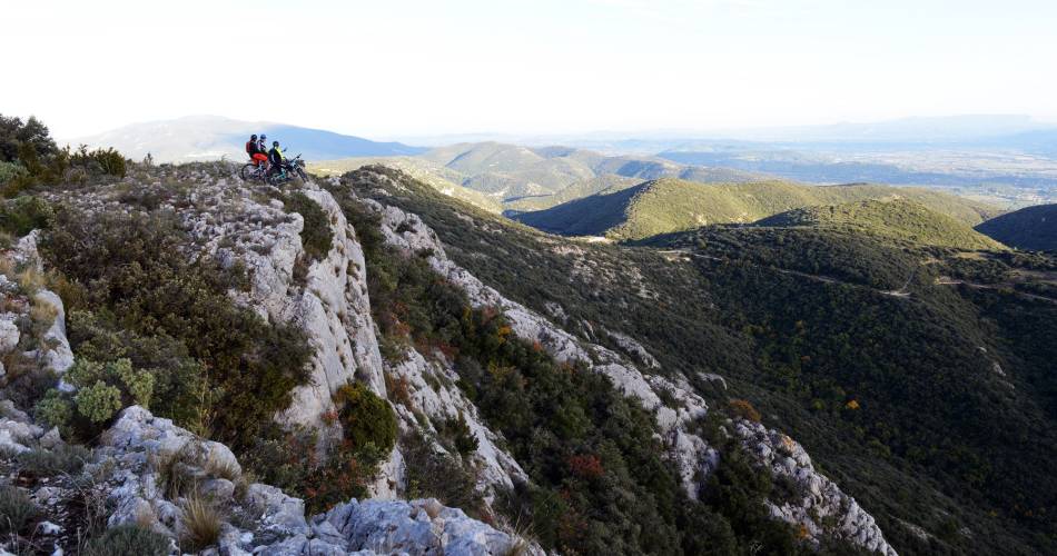
The route leads riders through the rocky southern slopes of the Petit Luberon then rises abruptly continuing to the majestic viewpoint at Le Portalas, and the mysterious Cedar Forest. This is the last section of the GT VTT (long distance mountain bike trail) and, in typical Provence fashion, finishes with a riot of fragrant scrub, rocky hollows and challenging trails.
The trail starts with an easy ride, along a wide path, up the southern face of the Petit Luberon. However, the last 100 metres, before you reach Le Portalas (690m) are far from easy, over uneven and challenging terrain. At the top, you can enjoy a spectacular view of the Durance Valley, the Crau de Camargue and the Alpilles. You’ll then cut through the Cedar Forest, with its majestic, one-hundred-year-old trees, a landscape typical of this section of the Provençal trail. After that, you’ll sweep down to the bottom of an unspoiled valley, continuing to the foot of the northern slopes of the Grand Luberon. Here, the vegetation creates a landscape of startling contrasts. Next, you’ll follow a succession of paths and trails, of varying levels of difficulties, into the foothills of the Petit Luberon, continuing until you reach Oppède-le-Vieux, a village steeped in history, and then Maubec.
From Maubec, you’ll quickly reach the medieval villages of Robion, along delightful single track paths, then Les Taillades, cycling alongside the mythical Carpentras Canal. From here, you’ll follow some pretty, windy trails, up the western slope and then the southern side of the Petit Luberon, through a mosaic of spectacular hilltops and deep valleys. A little further up, you’ll reach a succession of limestone plateaux: Le Trou du Rat, Les Mayorques and Saint-Phalez. This scrubland, shaped by man since the Neolithic Period, is characterised by lush valleys and a remarkable variety of wildlife, with exceptional birds, particularly, birds of prey. A final climb and then it’s time for a last dramatic descent along a pretty path, down to the old village of Mérindol, symbol of the persecution of the Waldensians in the Luberon.
From Maubec, you’ll quickly reach the medieval villages of Robion, along delightful single track paths, then Les Taillades, cycling alongside the mythical Carpentras Canal. From here, you’ll follow some pretty, windy trails, up the western slope and then the southern side of the Petit Luberon, through a mosaic of spectacular hilltops and deep valleys. A little further up, you’ll reach a succession of limestone plateaux: Le Trou du Rat, Les Mayorques and Saint-Phalez. This scrubland, shaped by man since the Neolithic Period, is characterised by lush valleys and a remarkable variety of wildlife, with exceptional birds, particularly, birds of prey. A final climb and then it’s time for a last dramatic descent along a pretty path, down to the old village of Mérindol, symbol of the persecution of the Waldensians in the Luberon.
Accéder à l'itinéraire
public transport
Zou Bus Lines 8&9Cavaillon - Cadenet - PertuisApt - Cadenet - Aix en Provence
View the Vaucluse bus timetable
recommended
parking(s)
Parking in the town centre
To be noted
Before departure, make sure to consult the Prevention of fire risks in Vaucluse website, to respect the massif closures. (T. +33 (0)4.28.31.77.11)
This itinerary is best suited to autumn and spring
 If you notice a problem on one of the Provence cycling routes report it with the Suricate app!: sentinelles.sportsdenature.fr
Access to the massifs
Respect the regulations preserving protected natural areas – find out about restrictions to accessing the massifs during fire risk periods, from 15 June to 15 September.
Before heading out, check the website
Respect the regulations preserving protected natural areas – find out about restrictions to accessing the massifs during fire risk periods, from 15 June to 15 September.
Before heading out, check the website
In short
- Ascent of the south face of the Petit Luberon (690 m)
- Stunning views of the Durance Valley, the Crau and the Alpilles.
- Cedar Forest and Century-old Trees
- Path along the bottom of a valley
- Discover the villages of Oppède le Vieux, Maubec, Robion, and Mérindol.
Contact
Vélo Loisir ProvenceE-Mail : info@veloloisirprovence.com
Website : https://www.veloloisirprovence.com
Facebook : https://www.facebook.com/veloloisirprovence/

