
40 - Touring the Comtat Venaissin by bike
40
Route
Loop
Difficulty
Intermediary
Duration
18h
Distance
113.06km
Positive elevation
1657 meters
Negative elevation
1 meters
Altitude
Min. 38 meters
Max. 444 meters
Departure / Arrival
Carpentras / Carpentras
Parking
Carpentras
Elevation
Downloads
GPX track
1 / 3
The tourist service at Carpentras :
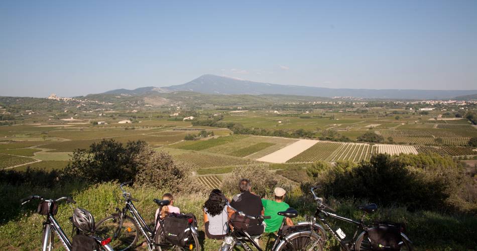
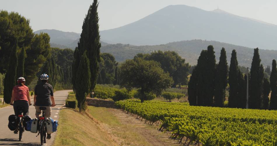
The Comtat Venaissin, land of art and history, is located in the heart of Provence at the foot of Mont Ventoux - a discrete territory of varied and protected landscapes.Accéder à l'itinéraire
public transport
Regional train line (TER): Avignon-Carpentras
recommended
parking(s)
Car Park at the Porte d'Orange
To be noted
 If you notice a problem on one of the Provence cycling routes report it with the Suricate app!: sentinelles.sportsdenature.fr
Access to the massifs
Respect the regulations preserving protected natural areas – find out about restrictions to accessing the massifs during fire risk periods, from 15 June to 15 September.
Before heading out, check the website
Respect the regulations preserving protected natural areas – find out about restrictions to accessing the massifs during fire risk periods, from 15 June to 15 September.
Before heading out, check the website
In short
- Small country roads that wind amidst orchards and vineyards and are ideal for cycling.
- Discovery of the Dentelles de Montmirail the Mont Ventoux piedmont.
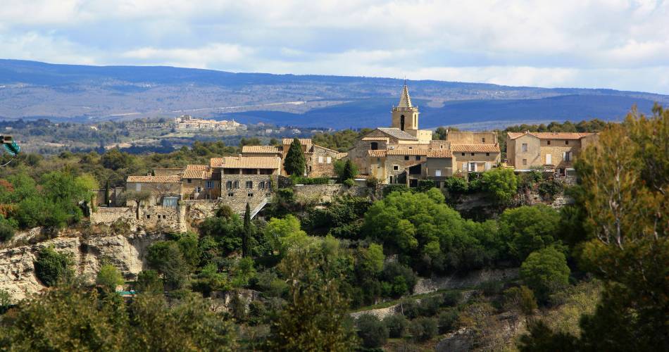
- Discovery of the Monts de Vaucluse and the villages that nestle in the hilltops, providing stunning views of Mont Ventoux.
- Visit of Pernes-les-Fontaines and Carpentras
Downloads
Contact
Parc Naturel Régional du Mont-VentouxE-Mail : carpentras@ventouxprovence.fr
Website : https://www.provence-a-velo.fr/equipements/mont-ventoux/40-le-tour-du-comtat-venaissin-a-velo/provence-4604199-1.html