
Gravel Dentelles

Route
Loop
Difficulty
Difficult
Duration
5h
Distance
48.22km
Positive elevation
1076 meters
Negative elevation
1 meters
Altitude
Min. 122 meters
Max. 565 meters
1 / 1
The tourist service at Vaison-la-Romaine :
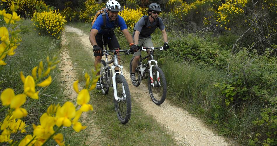
A superb route to discover the Dentelles de Montmirail, alternating between roads and paths.The loop is characterised by its multiple climbs and descents that follow the chiselled curves of the massif, with beautiful viewpoints!
Accéder à l'itinéraire
public transport
Consult the Zou bus lines that stop at RasteauConsult the Transcove wesbite, for access to the Dentelles de Montmirail.T.04 84 99 50 10
recommended
parking(s)
Rasteau departmental centre for outdoor activities
road access
Rasteau departmental centre for outdoor activities
To be noted
GPX required. The route is not signposted.
The route is best suited to spring, autumn, and winter.
In summer, consult the website to check access to the massif and fire risk
The route is best suited to spring, autumn, and winter.
In summer, consult the website to check access to the massif and fire risk
 If you notice a problem on one of the Provence cycling routes report it with the Suricate app!: sentinelles.sportsdenature.fr
Access to the massifs
Respect the regulations preserving protected natural areas – find out about restrictions to accessing the massifs during fire risk periods, from 15 June to 15 September.
Before heading out, check the website
Respect the regulations preserving protected natural areas – find out about restrictions to accessing the massifs during fire risk periods, from 15 June to 15 September.
Before heading out, check the website
In short
A gravel-bike experiene at the heart of the Dentelles de MontmirailA relatively difficult loop offering superb panoramic views of Ventoux and the vineyards of southern Cotes du Rhône.Many opportunities to discover gourmet treats at the heart of the hilltop villages of the Dentelles de Montmirail, and at the vineyards